PyNGL example map settings#
Software requirements:
Python 2 or 3
PyNGL 1.6.1
Run the map example script:
python PyNGL_map_settings.py
Script PyNGL_map_settings.py:
'''
DKRZ PyNGL Script: PyNGL_map_settings.py
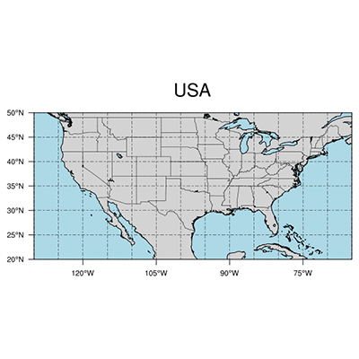
Description: plot a simple USA map
- show the use of map resources
09.02.21 meier-fleischer(at)dkrz.de
'''
import Ngl
#-----------------------------------------------------------------------
#-- Function: main
#-----------------------------------------------------------------------
def main():
#-- open a workstation
wkres = Ngl.Resources() #-- generate an resources object for workstation
wkres.wkWidth = 1024 #-- width of workstation
wkres.wkHeight = 1024 #-- height of workstation
wks_type = "png" #-- output type of workstation
wks = Ngl.open_wks(wks_type,"Py_map_settings") #-- open workstation
#-- set map resources
res = Ngl.Resources() #-- generate an res object for plot
res.nglMaximize = True #-- maximize plot in frame
res.tiMainString = "USA" #-- title string
#-- map resources
res.mpDataSetName = "Earth..4" #-- set map data base version
res.mpDataBaseVersion = "MediumRes" #-- MediumRes = Ncarg4_1
res.mpGeophysicalLineThicknessF = 2. #-- line thickness of coastal borders
res.mpFillOn = True #-- turn on fill for map areas.
res.mpLandFillColor = "LightGray" #-- fill color land
res.mpOceanFillColor = "lightblue" #-- fill color ocean
res.mpInlandWaterFillColor = "lightblue" #-- fill color inland water
res.mpOutlineOn = True #-- turn on map outlines
res.mpOutlineBoundarySets = "national" #-- "national"
res.mpOutlineSpecifiers = "conterminous us : states" #-- plot state boundaries
res.mpGridLatSpacingF = 5. #-- grid spacing for latitude
res.mpGridLonSpacingF = 5. #-- grid spacing for longitude
res.mpGridLineDashPattern = 7 #-- dash pattern for grid lines
res.mpLimitMode = "LatLon" #-- limit map via lat/lon
res.mpMinLatF = 20. #-- minimum latitude
res.mpMaxLatF = 50. #-- maximum latitude
res.mpMinLonF = -130. #-- minimum longitude
res.mpMaxLonF = -65. #-- maximum longitude
res.pmTickMarkDisplayMode = "Always" #-- turn on map tickmarks
#-- draw the map
map = Ngl.map(wks,res)
#-- done
Ngl.end()
if __name__ == '__main__':
main()
Result: